2014 - ColoradoRockies_Tour
4076 miles over 14 days. A tour through mostly backroad America in Tennessee, Kentucky, Missouri, Arkansas, Kansas, and Colorado.
This was probably the closest I'll ever get to the perfect tour...it don't get any better than this!
This was probably the closest I'll ever get to the perfect tour...it don't get any better than this!
Start slideshow
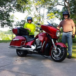 1 Ready to ride! |
 2 Colorado Video |
 3 Crossing the Mississippi into the boot heel of Missouri |
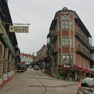 4 Downtown Eureka Springs. |
 5 Our Hotel, Basin Park, was located on the left |
 6 Built in 1905...and its haunted. |
 7 Basin Park Hotel courtyard |
 8 Basin Park Hotel courtyard |
 9 Uptown Eureka Springs |
 10 From the hotel resturant balcony |
 11 Eureka Scenes |
 12 Eureka Scenes |
 13 Leaving north out of Eureka on hwy 187 |
 14 A monument discovery in Kansas. Perfect for a break spot. |
 15 The flag standing straight out tells the story of our ride across the plains. |
 16 The site of the first christian service held west of the Mississippi. A few miles east of Dodge City, Kansas |
 17 A really big cow town |
 18 Dodge city outlaws |
 19 Santa Fe trail. Wagon ruts still here. |
 20 Kansas farm life |
 21 Wagon ruts on the Santa Fe trail |
 22 Entering Colorado on US 50 |
 23 A good sign on the Colorado plains near Colorado Springs |
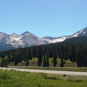
 24 Cheyanne Mountain |
 25 In the Garden Of The Gods |
 26 Garden Of The Gods |
 27 Pikes Peak as a backdrop to Garden Of The Gods |
 28 Our own Pikes Peak Hill Climb |
 29 Going up! |
 30 and up |
 31 To 14,110 ft. |
 32 Looking north east |
 33 Looking north |
 34 The Pikes Peak cog railway |
 35 Distance and scale become skewed to the eye. Somewhat like being airborne. |
 36 Rocky Mountain High Riders. (Not High Rocky Mountain Riders) |
 37 The ride down. (on the road that is) |
 38 The ride down. |
 39 The ride down. |
 40 They were getting ready for the Pikes Peak hillclimb, which was on the 27th |
 41 And on our way out. |
 42 We did actually see one in front of a resturant in Woodland Park dancing around with a poster. |
 43 The Columbine - State Flower |
 44 Up on Cripple Creek - where we spent the night. |
 45 Old hospital turned hospitality house. No rooms here tonight though. |
 46 A Gambling town. We just missed the Donkey Fest. Good thing, we wouldn't have gotten a room. |
 47 Good deal for the night at this casino...dinner included! |
 48 Heading for Montrose and the Black Canyon |
 49 Our first crossing of the continental divide on hwy 50 |
 50 At the Divide |
 51 Along hwy 50 west of Gunnison |
 52 The Black Canyon of the Gunnison |
 53 The Black Canyon of the Gunnison |
 54 The Black Canyon of the Gunnison |
 55 The Black Canyon of the Gunnison |
 56 The Black Canyon of the Gunnison |
 57 The Black Canyon of the Gunnison |
 58 The Black Canyon of the Gunnison |
 59 At the Black Canyon of the Gunnison |
 60 The Black Canyon of the Gunnison |
 61 Desending from The Black Canyon of the Gunnison towards Montrose. |
 62 The Black Canyon of the Gunnison |
 63 The Black Canyon of the Gunnison . Riding into the Canyon |
 64 Water diversion for the city of Montrose |
 65 On the way out. |
 66 Along the Million Dollar Highway (US 550). This road will not disappoint. |
 67 Ouray |
 68 Ouray |
 69 Ouray |
 70 Ouray |
 71 Ouray |
 72 Ouray |
 73 Ouray |
 74 Ouray |
 75 Red Mountain Pass |
 76 On the way to Silveron from Ouray on the Million Dollar Highway. |
 77 On the way to Silveron from Ouray on the Million Dollar Highway. |
 78 On the way to Silveron from Ouray on the Million Dollar Highway. |
 79 On the way to Silveron from Ouray on the Million Dollar Highway. |
 80 On the way to Silveron from Ouray on the Million Dollar Highway. |
 81 On the way to Silveron from Ouray on the Million Dollar Highway. |
 82 On the way to Silveron from Ouray on the Million Dollar Highway. |
 83 On the way to Silveron from Ouray on the Million Dollar Highway. |
 84 Overlooking Chattanooga Colorado |
 85 And this is all that is left of Chattanooga Colorado. |
 86 The Durango to Silverton pulls out of Silverton |
 87 Silverton |
 88 Silverton |
 89 Silverton |
 90 Silverton |
 91 Silverton |
 92 A D&R train making it's way into Silverton |
 93 High country view of a D&R train making it's way into Silverton as another waits to depart for Durango. |
 94 Climbing to Molas pass |
 95 Climbing to Molas pass |
 96 Climbing to Molas pass |
 97 Climbing to Molas pass - Mt. Snowdon |
 98 Entrance to Mesa Verde |
 99 Mesa Verde visitor center |
 100 Views from the Mesa |
 101 Southern view into New Mexico |
 102 Ship Rock, located in New Mexico, can be seen from our balcony at the lodge...50 miles alway. |
 103 Mesa views |
 104 Mesa views - looking northwest |
 105 Mesa views- looking north east |
 106 Meas view south |
 107 Ancient Pueblo ruins at Mesa Verde, NP. The Cliff Palace - circa 1200 - 1450 AD |
 108 Ancient Pueblo ruins at Mesa Verde, NP. The Cliff Palace - circa 1200 - 1450 AD |
 109 Ancient Pueblo ruins at Mesa Verde, NP. The Cliff Palace - circa 1200 - 1450 AD |
 110 Ancient Pueblo ruins at Mesa Verde, NP. The Cliff Palace - circa 1200 - 1450 AD |
 111 Ancient Pueblo ruins at Mesa Verde, NP. The Cliff Palace - circa 1200 - 1450 AD |
 112 Ancient Pueblo ruins at Mesa Verde, NP. The Cliff Palace - circa 1200 - 1450 AD |
 113 Ancient Pueblo ruins at Mesa Verde, NP. The Cliff Palace - circa 1200 - 1450 AD |
 114 Ancient Pueblo ruins at Mesa Verde, NP. Hiking to the Balcony House |
 115 Ancient Pueblo ruins at Mesa Verde, NP. Hiking to the Balcony House |
 116 Ancient Pueblo ruins at Mesa Verde, NP. Hiking to the Balcony House |
 117 Ancient Pueblo ruins at Mesa Verde, NP. Hiking to the Balcony House |
 118 Ancient Pueblo ruins at Mesa Verde, NP. There are over 600 identified dwellings in the Mesa Verde park area |
 119 The sun sets on ancient Pueblo ruins at Mesa Verde, NP. Circa 500 -700 AD. Before the ancients moved into the cliffs. |
 120 Our next goal can be seen to the north. The western slope and Tellruide. From the Mesa Verde. |
 121 The Sunsets on the Ute Mountains in western Colorado. Just beyond - Utah. |
 122 The Sunsets on the Ute Mountains in western Colorado. Just beyond - Utah. |
 123 Lizard head pass |
 124 Lizard head pass panorama |
 125 At Lizard head pass. A Picture Perfect day! |
 126 At Lizard head pass. A Picture Perfect day! |
 127 A lizard head at Lizard head pass. A Picture Perfect day! |
 128 Telluride area |
 129 Telluride area |
 130 Telluride area |
 131 Telluride area |
 132 Telluride area |
 133 Running north on hwy 141, target - Grand Junction and the Colorado Nationl Monument. |
 134 Running north on hwy 141, target - Grand Junction and the Colorado Nationl Monument. |
 135 A break under the cottonwoods along hwy 141 |
 136 |
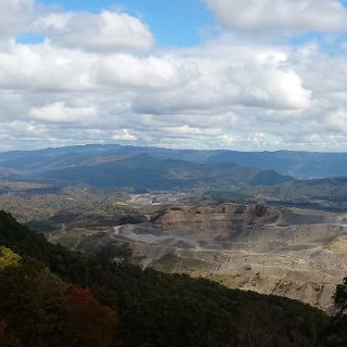
 137 An old gold mining sluice on hwy 141, remnants from the gold rush days |
 138 Just what is down that road? Time to find out. |
 139 Canyons. No traffic, no nothing for 50 miles. |
 140 Solitude is a clear cool stream lined with cottonwoods in a deep canyon. |
 141 Colorado National Monument. |
 142 A perfect morning ride! |
 143 Colorado National Monument. The way up on the north side |
 144 Features |
 145 Desert Flower |
 146 Look close at the top of the tower...see next photo. |
 147 Now what? |
 148 Coke stove monument |
 149 What a ride! |
 150 Too much to see and too far to see! |
 151 Echo Canyon. See if you can find the mummy casket . |
 152 Shivers point. |
 153 Shivers point |
 154 A Shivers point lizard tries to warm up. |
 155 Shivers point. Appropriately named - winds are howling here. Fruita Co and the western slope is beyond. |
 156 From near the top of the Grand Mesa. Roadway climbs from 3000 ft to about 11,000 - a breathtaking ascent! |
 157 From near the top of the Grand Mesa. Roadway climbs from 3000 ft to about 11,000 - a breathtaking assent! |
 158 From near the top of the Grand Mesa. Roadway climbs from 3000 ft to about 11,000 - a breathtaking assent! |
 159 A loo break at 11,000 ft. |
 160 Playing in the snow |
 161 Working our way up to Independence Pass |
 162 Working our way up to Independence Pass |
 163 Birch trees line the road to Independence Pass. |
 164 Ghost towns are numerous |
 165 Old settlements are numerous - this one well preserved for the tourists. |
 166 Almost to the top! |
 167 Looking back as we climb. |
 168 Independence Pass |
 169 Independence Pass |
 170 Independence Pass |
 171 Independence Pass . It was cold...no, it was very cold here. |
 172 Brrrrrrr! It was worth it though! |
 173 Independence Pass . Alpine wild flowers in bloom. |
 174 Time to head down for some slightly warmer temperatures. Heated seat and grips on please. |
 175 Descent |
 176 Twin Lake. |
 177 Snow showers follow us up the valley to Leadville where we will spend another night above 10,000 ft |
 178 Our morning greating at the hotel in Leadville. Mt. Ebert and Mt. Massive, both over 14,000 ft |
 179 A quiet morning in Leadville. Note the thermometer on the back building. |
 180 Sorry, not this time of the morning. |
 181 Mt Evans. |
 182 At the top of Mt Evans. This is the highest paved road in the country. Note Susan fogging up! |
 183 The helmets never came off for a reason. 32 degress and a 30 mph wind = windchill |
 184 Cool |
 185 Leaving the top |
 186 KEEP YOUR EYES ON THE ROAD! |
 187 Echo Lake at the foot of mt Evans. We begin our exit of the mountains. |
 188 Red Rocks |
 189 At Red Rocks. We couldn't see the stage because they were prepping for a concert this night. |
 190 A last look back across the Colorado Plains. We exited through Castle Rock and out hwy 86. See the map for how far out we were. |
 191 Goodbye Colorado , for now. |
 192 Chisholm and Santa Fe trail intersection. Near Eldorado Kansas. |
 193 A new kind of crop in eastern Kansas |
 194 Old Route 66 in western Missouri northeast of Joplin. |
 195 Big Oak Tree Missouri state park near New Madrid, just across the Mississippi from Kentucky . |
 196 Our ride across the Mississippi has almost arrived. |
 197 One of the last of the Mississippi Ferry boats. |
 198 We had the boat to ourselves. |
 199 Well, we're not really that tired. 4076 mile total and near perfect weather. It doesn't get any better than this! |